Make Way for Fish
By Eileen K. Straughan
Natural stream channels in urban and suburban environments in the Mid-Atlantic region are impacted by streambed and bank erosion accelerated by development that lacked appropriate stormwater management controls. In response to increased watershed impervious cover and subsequent increased flow volume and velocity, stream channels have eroded and incised and, over time, have become disconnected from natural vegetated floodplains.
As stream channels erode and incise in response to changed hydrology, utility infrastructure previously installed in the floodplain is often exposed and damaged by fallen trees and other debris that can be carried in-stream during flood events. In addition to the obvious risk of sewage overflows to water quality and the negative effect of non-sewage inflows to the sewer on system capacity, exposed sewers in the stream bed form barriers to fish passage, affecting the ability of native fishes to access upstream habitat for reproduction.
A comprehensive study conducted on behalf of the Washington Suburban Sanitary Commission (WSSC) analyzed the Beaverdam Branch Sewer Basin to evaluate the condition of sewer pipes and manholes exposed within or near stream channels.
The Beaverdam Creek watershed is located north and east of Washington, DC, within the Western Coastal Plain Physiographic Province. The Beaverdam Branch Sewer Basin comprises over 180 miles of sewer pipes ranging in size from 6 to 66 inches in diameter, and transports eight million gallons of sewage per day to the Blue Plains Wastewater Treatment Plant in Washington, DC.
Due to the urban nature of the watershed and the highly erodible soils, stream channels in the Beaverdam Creek Basin have become deeply incised. The purpose of the study was to determine whether the sewer infrastructure is adversely impacting aquatic wildlife migration and whether the sewer system is in satisfactory operational condition. The study included development of a protocol to index and rank stream restoration at sites where barriers to aquatic wildlife migration exist.
Methods
The Anacostia River Stream Corridor Survey (DNR, 2005) and WSSC sewer maps were reviewed to identify potential exposed sewer pipe locations within the Beaverdam Creek watershed, and then a field review was conducted to verify this information and identify additional sites. At each site, the condition of the sewer infrastructure relative to the stream channel was evaluated. At sites where sewer infrastructure was exposed within a stream channel and influencing channel processes, a standard data sheet and a survey of stream morphology was conducted. Each surveyed site was ranked based upon its impact to aquatic migration and the amount of ecological benefit that would result from restoration of aquatic migration at the site.
Data was recorded for each survey site regarding the condition of stream banks and riparian vegetation, the type, extent, and working condition of exposed sewer infrastructure, the impact severity to the utility (i.e., the potential for the utility line to receive surface water infiltration or to exfiltrate contents), the quality of fish habitat at the site and the estimated cost and effort required to restore the site. Channel dimensions, slope, bankfull depth, high water level, and riffle/pool depth were determined from channel survey. Stream velocity at the exposed sewer infrastructure was calculated using Manning's equation and discharge at the riffle cross-section.
The quality of fish habitat at each ranked site was determined in the field using the Maryland Biological Stream Survey (MBSS) Habitat Assessment Guidance Sheet developed by the Maryland Department of Natural Resources (2001). This protocol designates numerical scores for the quality of habitat parameters such as variety of habitat types, stream shading, substrate type (for macroinvertebrate survival and fish spawning), and human influence. The individual MBSS parameter scores were converted into an overall habitat score for each site by adding all of the parameter scores.
"Cost and Effort" was determined on a sliding scale based on accessibility of the site and the amount of disturbance to stream and sewer lines required to fix the utility exposure. "Impact Severity to the Utility" was determined using WSSC protocol, which considers the percentage of exposed sewer infrastructure and its effect on stream flow.
Ranking Parameters
Each site was ranked and prioritized based upon its impact to aquatic wildlife migration and the potential benefit of restoring the site based upon the following four parameters:
- 1. Watershed Position
- 2. Habitat Quality
- 3. Nature and Type of Barrier
- 4. Cost and Effort
Each of these parameters was given an index score based upon its restoration potential. These scores were then inserted into an equation to determine the overall index score. Only the 20 exposed sewers with the highest overall index scores are considered in the actual restoration strategy.
Findings
Seventy-five exposed sewer sites were identified through review of Maryland DNR data, WSSC sewer maps, and field searches. Each site was visited and evaluated for its impact on the riparian environment, with a specific focus on fish passage. A total of 39 sites were surveyed and ranked. Based on the index ranking, 20 sites were identified as priority sites for restoring aquatic migration. Restoration of these sites would have the largest benefit toward improving aquatic habitat in the Beaverdam Creek watershed.
Six of the 20 priority sites for restoration had broken sewer infrastructure. Thirteen additional sites not identified as priority restoration sites were observed to have broken infrastructure during the field investigations. Broken sewer infrastructure can threaten water quality, which affects the abundance and diversity of local fish populations and causes a public health concern. Broken infrastructure sites with low severity are currently impacting aquatic habitat the least but would also be the easiest sites to fix. High and very high severity sites are degrading water quality, and will likely require replacement of part of the sewer line in order to fix the problem.
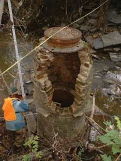
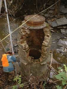
Most of these sites are located low in the watershed, resulting in a greater improvement to fish populations in the entire Beaverdam watershed if the barriers are removed. Of these sites, 55% (11 sites) are exposed pipes and 20% (4 sites) are exposed manholes. The remaining 25% (5 sites) have both an exposed pipe and manhole impacting the waterway. The majority of the priority sites are fish migration barriers because water depth passing over or near exposed sewer infrastructure is too low for fish passage. Usually this problem occurs where stream flow passes over a pipe or encasement but it also occurs where exposed manhole stacks have caused accelerated stream bank erosion, leading to an over-widened, shallow stream channel.
Nineteen of the 75 sites visited exhibited broken sewer infrastructure, and six of these 19 sites are among the 20 highest priority restoration sites. However, it should be noted that broken sewer infrastructure can threaten water quality, which also affects the ability of fish populations to thrive; therefore, the 13 non-priority sites with broken infrastructure do affect fish populations to some degree and could cause more serious impacts if left unchecked.
Restoration of Fish Migration
Based on the assessments, four primary causes for stream erosion induced fish migration barriers existed. These problems were addressed using in-stream structures or by reconfiguring the stream morphology. Removing the fish blockage altogether is the best solution to ensure the success of the restoration; however, this may not be practical for most sewer structures.
Replacement of Sewer Infrastructure
The 19 site locations with broken sewer pipes or manholes will likely require replacement of sewer infrastructure. Sites with low severity breakages can be repaired immediately, while replacement of pipes with severe breakages could be considered for future upgrades. Leakage of raw sewage into the stream may pose a health hazard and thus those sites are highest priority sites for sewer line repair.
References
Maryland Department of Natural Resources: Monitoring and Non-Tidal Assessment Division. Maryland Biological Stream Survey Sampling Manual. Annapolis, MD, 2001.
Maryland Department of Natural Resources: Watershed Services. Anacostia River Stream Corridor Assessment. Annapolis, MD, 2005.p
Washington Suburban Sanitary Commission: Major Projects and Outreach. 2005. http://www.wssc.dst.md.us/projects/Beaverdam/index.htmlp
About the Author: Eileen K. Straughan is President of Straughan Environmental, a woman-owned firm located in Columbia, Maryland, offering a full range of environmental consulting services to public and private clients.

