Water Utility Turns to Modeling to Optimize System
The City of Cocoa in Florida has an unusual, if not unique, claim to fame - it is the official supplier of water to the moon, as Cape Canaveral’s local water provider. Now, the city’s water distribution system is being modeled in InfoWorks WS to provide the engineering division with valuable information on its small but vital network.
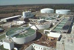
Cocoa is on the Atlantic coast of Central Florida, in Brevard County, close to NASA’s Cape Canaveral Air Force Station and Kennedy Space Center. The water network began expanding in the 1950s when the US government came to the area looking for a supplier to provide water for the space program. During the 1960s Cocoa became a regional water supplier and now serves a population of 250,000 and produces an average of 30 mgd.
The distribution system serves the cities of Cocoa Beach and Cape Canaveral, Patrick Air Force Base, Port Canaveral located on a barrier island, Merritt Island, as well as Port St John, Rockledge, Titusville, Suntree, Viera, and various other areas located on the mainland. The population growth, and associated growth in the demand, is a major issue for the water utility - Brevard County is third in the list of fastest-growing areas in the US.
System Modeling
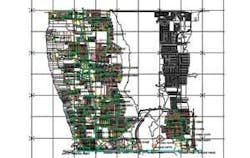
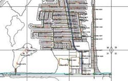
To better manage the system, modeling was initiated in 2004 looking at the South Mainland. This first model was converted by consultant CH2M Hill into InfoWorks WS and expanded. A separate model for Merritt Island and the beaches was created manually. The data for North Cocoa and Point St John models were imported from CAD drawings using automated InfoWorks import and data correction tools.
The South Mainland model was originally created to fine-tune the size of a proposed new 42 inch transmission main to the rapidly developing areas of Viera, which had been suffering flow and pressure problems. Later, the model was used to identify bottlenecks in the existing system and pinpoint the best spots to connect to the new water main.
Completed and ongoing projects include sizing the new South Mainland transmission main and solving pressure and flow problems for the long stretch of Merritt Island, which is 10 miles long and has a water supply network that connects to the mainland at only two points. The model was used to identify weak parts of the system, and work is currently under way to recommend the most effective ways to strengthen it by adding extra connections.
Current challenges also include the development of a GIS database. InfoWorks WS model data will be used as the initial seed for developing the database. Additional projects include the importation of data from AutoCAD drawings for the remaining areas of the system and the integration of all the partial models into a single, integrated model.
The utility also plans to use InfoWorks WS for emergency and catastrophic event modeling - the area suffers hurricanes every year, with 2005 being a particularly bad season. The model would test different emergency scenarios: for example, storm surges inundating the low-lying barrier islands from Cape Canaveral - to Patrick Air Force Base - Merritt Island and Cocoa Beach, causing them to sustain catastrophic damage resulting in massive water leaks.
“Early studies before the construction of the Space Center predicted that no major hurricane would ever come through there, but things change,” said City Engineering Division Manager Igor Vassiliev.
The model has to identify the transmission mains that need to be shut off in advance, and the valves that need to be partially closed to minimize water losses while still providing service for parts of the system at a reduced pressure.
“This can easily be done in the InfoWorks model, showing which parts will need to be closed or partially shut down - you don’t need maps to figure it out,” Vassiliev said.
Plans for the future include a wellfield model, adding Taylor Creek reservoir and the ASR wells to the existing model, as well as the northern part of the system to the city of Titusville. Also planned are reclaimed water system modeling - the city achieved zero discharge status last year - and sewer system modeling using InfoWorks CS.
