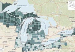
A screenshot shows how the social and economic characteristics of the Great Lakes Region are impacted by regionally specific changes in climate.
|
"We anticipate that the impacts of climate variability and change will be felt differently in different regions of the Great Lakes based on their economies, infrastructure and vulnerable populations," said Don Scavia, director of the Graham Sustainability Institute. "This collaboratively-built resource is designed to give these communities some of the solutions-focused, place-based climate science they need to adapt."
Elizabeth Gibbons, GLAA-C project manager and research area specialist, further explained: "The interactive map is geared toward helping stakeholders see how changes in climate interact with social, economic and land-use changes across the region. We're really hoping it proves to be a valuable tool for all the municipalities who use it."
The online tool -- which includes historical data from 1951 to 2011 -- covers counties in the states of Minnesota, Wisconsin, Michigan, Illinois, Indiana, Ohio, Pennsylvania, and New York. U-M and Headwaters Economics expect to co-develop a similar map for Ontario in the months ahead.
Multiple people contributed toward planning and previewing the resource, including stakeholders from the state of Michigan's Community Health Department; the cities of Ann Arbor, Cleveland, Dayton, Flint and Toledo; U-M faculty members from urban planning, public health and natural resources and environment; and staff members from the Graham Sustainability Institute, the Great Lakes Integrated Sciences and Assessments Center and Headwaters Economics.
The online map is available for use at no cost through both the Graham Sustainability Institute website and Headwaters Economics website.
###


