Regional Wastewater Agencies Integrate Storm Drain Maps
Los Angeles County has a complex series of overlapping jurisdictions for water, wastewater, and stormwater. With nearly 80 cities within the county, management of these utilities has always posed a unique challenge. One of the largest regional agencies, the County Sanitation Districts of Los Angeles County (LACSD), was charged with collecting and treating most of the wastewater generated outside of the boundaries of the City of Los Angeles.
As the 1990’s drew to a close, a rising movement in stormwater protection was gathering steam. New NPDES permits had been issued to the county as well as local agencies. These permits required the agencies to take a more proactive approach to managing the storm drain system. As part of this process, agencies frequently wanted to divert dry weather storm drain flows into the sanitary sewers operated by LACSD in order to treat non-stormwater flows before discharge to the ocean.
When these new sources of wastewater began to multiply, managers at LACSD realized that there was no good regional maps of the storm drain system. Each city had its own collectors that drained into various county and Army Corps drainage systems. Each agency maintained its own maps and did not track the path of water from their system all the way to the ocean.
This was an issue for LACSD management because they did not have good records of where various flows that were entering the system through dry weather diversions were originating, making detection of pollution sources nearly impossible. LACSD also wanted to have good storm drain records in order to properly manage the infrequent, but potentially costly sewer overflows. Without a good map showing where a given spill was headed, LACSD crews had difficulty deploying resources to the right places in the event of a spill.
Sean Christian, Senior Engineer, Planning & Property Management at LACSD, spearheaded a regional effort to correct this problem. Working with a group of stakeholders that represented the various cities, the county, the Army Corps, as well as regulatory agencies and environmental groups, Christian developed a project to build a regional stormwater mapping system that would be available to all stakeholders.
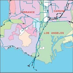
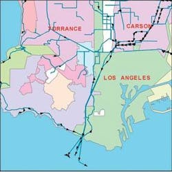
Nobel Systems was selected through an RFP process as the contractor and has completed the first portion of the project consisting of a dozen South Bay area cities. Source data was gathered in both paper and digital form from each of the agencies and a seamless GIS-based map was developed. This map does not stop at municipal boundaries as before, but follows pipelines from agency to agency until they reach the point of discharge.
Nobel Systems collected source data in a variety of formats from each of the cities involved as well as the County of Los Angeles Department of Public Works, CalTrans, and the Army Corps of Engineers. Some data was already in digital format and other data was still paper based. Using a countywide database model that was selected by the team as a whole, Nobel captured data from the various sources and entered it into the GIS database.
The end result is a seamless GIS database linking each catch basin in the county with every other element in the stormwater conveyance system. This new map identifies each feature in the system as to its owner, operator, as well as standard items such as size and material of pipe. A complete geometric network has been established that ensures complete connectivity between all features.
The data has been deployed on Nobel’s web-based GIS software, GeoViewer Online and is available to all stakeholders using standard web browsers. Users can view the map, turn layers on and off, print detailed maps, and many other functions. All of the paper as-built sources have been scanned and linked to the system for easy retrieval. Most importantly, users can trace up or down stream by clicking on a pipe or a catch basin. The system will automatically trace the flow route from that spot to the end of the line, showing how the water is passed from one agency to the next and the ultimate discharge point. This is a benefit to all stakeholders, as it facilitates rapid and accurate responses to spills and other events.
As the project progresses, future applications may include live display of water quality data on GeoViewer Online as well as the display of compliance information that shows the efforts that each agency is making to protect water quality.
More information on the on-line GIS software can be found at Nobel System’s website, www.nobel-systems.com.

