Modeling Software Helps Engineers Repair New Orleans Levees
By George Demmy
Less than a week after Hurricane Katrina slammed ashore New Orleans on August 29, 2005, U.S. Army Corps of Engineers Brigadier General Robert Crear created Task Force Hope. Comprised of Corps staff, the Hurricane Protection Office (HPO), the New Orleans District Protection Restoration Office and the Memphis District&srquo;s Louisiana Recovery Field Office along with engineers and experts from firms like Evans-Graves Engineers, PBS&J and HDR Engineers, Task Force Hope was given the mission of repairing, restoring and improving the New Orleans levee system to accommodate 100-year return events. The Task Force was also charged with helping citizens, homeowners and businesses better determine flood risk and insurability levels.
With a budget of almost $6 billion, a project deadline of 2011, and a need to maximize the application of geospatial data in a variety of environments, Task Force Hope chose to use software from TerraGo Technologies to help communicate and collaborate with the diverse partners, stakeholders, and concerned citizens in the completion of its important mission.
Removing Barriers with GeoApps
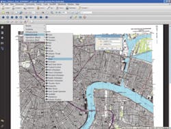
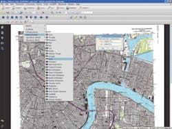
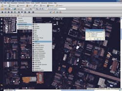
TerraGo software enables engineers and project managers to work with their GIS departments to deliver GeoApps, which are software applications that give non-GIS users the ability to access, configure and consume geospatial data in an easy-to-use format. More specifically, GeoApps leverages specially-configured GeoPDF files in conjunction with the TerraGo Toolbar, TerraGo Map2PDF software and Adobe Reader to deliver applications that allow users to view and mark-up maps, inspect data, perform analysis, and collaborate with colleagues within a familiar Reader environment.
“We&srquo;re working with many engineers and project managers who don&srquo;t have a background in the use of complicated GIS applications, yet need access to detailed georegistered maps with features and attributes,” said James Stevenson, senior GIS analyst for the HPO. “They have to be able to perform basic GIS tasks in the field and update information, and we need the ability to pull those updates back into GIS datasets.”
With this system, users can view and update geographic information whether they&srquo;re connected to the Internet or not, which is important for projects like the levee restoration where connections are often intermittent. When connectivity is available, users can collaborate and share data, a process that allows decision-making based on the most updated information.
“A part of this project is the re-evaluation of the levees — how high, how big, what their alignment needs to be. Our engineers are using geo-enabled PDF files to mark up and realign information to better plan how the levees need to be designed to provide 100-year protection levels. Using the files, they can look at the levees, try different scenarios and make better decisions,” Stevenson said.
Creating GeoApps
The HPO uses Map2PDF for ArcGIS to take the map layouts generated from their GIS system of record and create geo-enabled PDFs, or GeoPDFs. The GeoPDF files are enabled for GeoMark collaboration by a combination of Adobe enabling technology and Map2PDF for Acrobat. HPO maintains a library of GeoMark-enabled GeoPDF-based maps that can be delivered by email, CD, or thumb drive. Engineers and non-GIS experts can mark up maps, share those mark-ups with other users, or import them into a GIS system. Additionally, they can query feature attributes, toggle layer visibility and display a variety of mapping data including latitude and longitude — powerful analysis capabilities typically associated with highly specialized GIS and visualization tools.
“We use GeoPDF files for briefings, so we can make changes right there based on input from decision-makers. We can then field-verify the data and ship the information back to the GIS for quality control — all from the same file,” Stevenson said.
Ease of use is one of the most important benefits of the GeoPDF-powered applications for HPO because everyone from GIS analysts to field engineers to politicians to citizens-at-large will be using these maps.
“The learning curve for other solutions proved to be an obstacle. Everyone here has Adobe products and is already comfortable using them,” he said. “We have had very positive feedback so far.”
Stevenson also pointed out that the geo-enabled PDF solution is highly portable and gives the HPO more flexibility in how they use data since the files are network agnostic. “Basically, we can package up whatever geographical datasets are needed, whether they&srquo;re for engineers, managers, decision makers or even citizens, and they can use that data anywhere, whether they&srquo;re connected to the server or not,” Stevenson said. “We can&srquo;t install a GIS system on everybody&srquo;s computer, so GeoPDF allows us to give everyone the data they need without that infrastructure and expense.”
Summary
Difficult but very valuable lessons were learned in the aftermath of Katrina. “If you can&srquo;t access the web, a lot of mapping data is totally useless,” said Stevenson. “Using GeoPDF files, everybody can have GIS data available in a way it&srquo;s never been before. We can just hand people a CD with the data they need, and they&srquo;re able to get to work.” uwm
About the Author:
George Demmy Ph.D. is co-founder of TerraGo Technologies and currently serves as Director of Product Management. He designed the georegistration technique used in GeoPDF. Demmy received his Ph.D. in Agricultural Engineering, Hydrologic Sciences Academic Cluster, from the University of Florida.


