Centralized Stormwater Management Key to Redevelopment Success
By David Misky and Cynthia Nemke
By the mid-1960s, the city of Milwaukee’s population had reached nearly 750,000 due to the large influx of immigrants during the previous century. The majority of those immigrants worked in blue-collar jobs, making Milwaukee a powerhouse of industry. Because of its easy access to Lake Michigan and other waterways, Milwaukee’s Menomonee River Valley has historically been home to manufacturing, stockyards, rendering plants, shipping, and other heavy industry.
By the late 1990s, manufacturing jobs in the Menomonee River Valley region, which included the Milwaukee [Rail]Road “Shops” facility, had decreased from 50,000 to less than 7,000 jobs. The prevalence of a high unemployment rate resulted in a negatively impacted economy for the Valley’s neighborhoods.
The former Milwaukee Road Shops facility built and serviced railroad cars and locomotives from 1879 to 1985, when it declared bankruptcy and closed, leaving dozens of vacant and dilapidated buildings and acres of contaminated land. The Redevelopment Authority of the city of Milwaukee (RACM) acquired the property in 2003 and implemented an innovative master plan for a new industrial and recreational development, the Menomonee Valley Industrial Center and Community Park (MVIC).
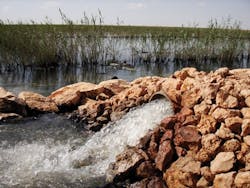
Figure 1: Looking south across stormwater management area No. 2 after a storm event. During larger storm events, water flows both on the surface and in the subsurface through the stormwater park.
After the city acquired the property, an integrated redevelopment strategy was implemented to concurrently decommission, demolish, remediate, and construct new infrastructure at the site. Since 2003 the MVIC has added 700 sustained jobs to the Menomonee Valley area — with a projection for at least 1,200. The development provides economic, natural, and sustainable benefits to the region, but one of the cornerstones of its success is its centralized stormwater management facility — the “stormwater park” that services 70 of its 100 acres.
Innovative Design Provides Stormwater Treatment and Recreational Space
The state-of-the-art stormwater management system at MVIC was conceptualized in a national design competition held for this project. The stormwater park is a multiple-use public park and stormwater management facility. The two functions are closely integrated: subsurface stormwater storage and treatment cells are overlain by a sequence of restored naturalized landscapes, which detain and treat urban runoff and create a setting for park components, including multiple-use trails, soccer fields, gathering spaces, and even a canoe launch. Park pathways that link to both regional and local trail systems define the edges of the water management basins.
The stormwater park was designed and built to achieve a high degree of water treatment and to effectively reduce peak flood flows. Innovative and sustainable techniques create a base flow of water back to the Menomonee River — mimicking natural river hydrology.
Water management within the park is achieved through a series of stormwater basins expressed at the surface as topographic depressions but with extended holding capacity in subsurface treatment cells. Sustainable elements of the design include the use of recycled construction materials such as crushed concrete from former site structures and from a nearby highway project (versus importing “new” building stone).
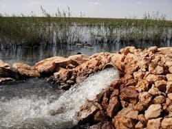
Figure 2: Ground level view of the northern portion of Stormwater Management Area No. 2.
Surface forms of the basins are ponds, wetlands, wet meadows, and turf. Plantings of indigenous species appropriate to each basin’s designed moisture capacity enhance and enrich local ecological habitats.
In-Series Treatment
A conventional piped system that includes inlets, pipe, and outfalls delivers storm flows from the development’s land parcels and roadways into the stormwater park. The facility treats the runoff from 60 acres of private industrial development and 10 acres of roads, so that stormwater from the MVIC does not enter Milwaukee’s combined stormwater treatment system, resulting in a cleaner Menomonee River and Lake Michigan.
A series of three stormwater management areas (SMAs) are hydraulically linked together in the park. Each SMA accommodates a specifically-designed water volume and vegetation appropriate to the expected degree of water retention. SMA No. 1 is the most “upstream” area, and is situated at the highest topographic elevation, followed by SMA No. 2, which is somewhat lower. SMA No. 3 is at the lowest elevation and immediately adjacent to the Menomonee River. This third unit is also referred to as the “swamp forest” based on the types of vegetation — adaptable to frequently wet conditions and providing water uptake to transpire some of the water out of the system — that were planted there.
Precipitation from smaller storm events infiltrates the ground within the developed area and at each SMA. Runoff during higher storm events leaves the developed area and is piped directly into topographically-higher SMAs 1 and 2, connected to each other by both subsurface zones filled with the permeable treatment material and by a controlled V-notch weir at the surface. Stormwater is treated as it travels into the treatment cell portions of these two SMAs where water is isolated from underlying environmentally-impacted groundwater using a 1- to 2-foot compacted clay subgrade. Permeable treatment materials are situated above the clay in the two subsurface cells — the material types coordinate to maximize stormwater absorption and vegetative uptake. The treatment material allows for both filtration and biological processes that remove at least 80 percent of total suspended solids and phosphorus, nitrogen and heavy metals. The native vegetation planted at the basin surfaces maximizes evapotranspiration and reduces the volume of stormwater that reaches the river.
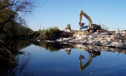
Figure 3: Limestone blocks adorn the downstream edge of the stormwater park. Both decorative and functional, these blocks allow for seepage from the lowest elevation in the system out to the Menomonee River.
Storm drainage reaches the swamp forest from SMA 2 in two ways: through a controlled outlet structure and through the subgrade treatment gallery that extends from SMA 2 and into the swamp forest, but not beneath it. To encourage the growth of the required wetland plant species, the bottom of the swamp forest basin comprises two feet of compacted clay, but no permeable material. There is also crushed concrete on the “downstream” side of the swamp forest that extends to the river. The presence of this permeable zone between the swamp forest and the river allows seepage to occur in both directions, to and from the river, depending on river stage. If water elevation in the stormwater park exceeds the topographic elevation on the downstream side of the swamp forest, water overflows the system into the river.
Developing Benefits Continue
The MVIC project has won numerous awards and is a state- and federally-recognized Brownfields redevelopment success story with economic, recreational, and ecologic sustainability components. The innovative stormwater park design provides stormwater treatment that exceeds stringent discharge requirements and maximizes available development space. Private developers at MVIC are guaranteed stormwater treatment in this regional system, allowing them to fully utilize their parcels for building.
Both recreational and stormwater treatment aspects of the stormwater park are managed by a public/private partnership where annual fees are assessed to property owners for the maintenance of the stormwater system — so individual parcel owners within the development contribute to the maintenance costs but do not have direct responsibility for its operation and maintenance.
Building the stormwater park has also enhanced ecological and recreational benefits, which in turn contribute to the natural resource value of the development by an estimated $120 million. These benefits include:
- 70 acres of industrial park with no storm sewers;
- Vastly improved river ecology;
- 45 acres of restored wildlife habitats and native plants;
- 3,000 feet of riverbank restoration benefiting flood control management;
- Three state-of-the-art fields for soccer and other field sports;
- Three miles of biking and walking trails, with connections to regional and state trail systems;
- Newly established river access via a new canoe ramp;
- 22 neighborhood schools partnering with the Urban Ecology Center to strengthen their science curricula;
- 10,000 student visits annually, using the Menomonee River Valley as their outdoor science laboratory.
About the Authors:
David P. Misky is Assistant Executive Director of the Redevelopment Authority of the City of Milwaukee (RACM). He has led the redevelopment effort at the MVIC site since joining the city of Milwaukee in 2003. He can be contacted at 414-286-8682 or via e-mail at [email protected].
Cynthia Nemke is an Environmental Remediation Manager with CH2M HILL, Inc. She can be contacted at 414-272-1052 or via e-mail at [email protected].
MVIC Project Recognized for Excellence
The MVIC Project is a distinguished winner of a 2009 Phoenix Award, awarded to 10 Brownfields Redevelopment projects across the United States on an annual basis. The award is given by the Phoenix Awards Institute, a non-profit entity dedicated to recognizing these great projects. This year’s awards will be officially presented to project stakeholders during the U.S. EPA’s Brownfields 2009 Conference in New Orleans in November.


