The Utility Network: Preparing for the Future
When the San Juan (Calif.) Water District’s (SJWD) legacy CAD-based GIS system lost its ability to communicate across departments, it created bottlenecks and data silos. Collaboration became a struggle as staff began to rely on disparate datasets, paper map books, and outdated systems. It was time for a change. SJWD needed a solution that would repair the damage, but more importantly ensure a sustainable future.
A needs assessment identified five primary requirements for the new system:
- Technical support and online resources for problem solving, troubleshooting, and training.
- Integration with important business systems: CMMS, hydraulic modeling, customer information system and document management.
- Capability to transition paper map books to digital resources.
- A collaborative environment that would enable streamlined workflow between engineering, customer service, and operations departments.
- Ability to be hosted internally while providing access to the system network across the organization.
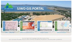
SJWD chose Esri’s ArcGIS platform: ArcGIS Enterprise, ArcGIS Pro, and the Esri Utility Network provided the framework that would meet their needs. Technical support is available 24/7 via phone, web, and even through a support app. There is a large water industry community to connect with and learn from. Online e-learning is available and training plans can be developed for individuals or groups.
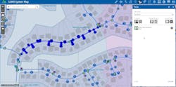
The field services paper map book has been replaced by a digital GIS map book, which is now available on desktops and on tablets giving crews access to accurate and up to date information. The engineering group maintains the GIS data and shares information with the entire organization using web maps and dashboards. The use of web applications helps the engineering department work closely with customer service and field services by communicating project details and the status of activities in real time.
Improved communication between the different business groups and integrated work processes have increased organization engagement, awareness, and has enabled SJWD to quickly react to the needs of the system and their customers. The implementation of the ArcGIS platform has improved the work being done today and prepared SJWD for the future. WW

