Going Digital: Preserving Institutional Knowledge and Securing the Future
The Northern Gila County Sanitary District (NGCSD) is a small utility responsible for wastewater collection and treatment, reuse water production and distribution, and biosolids remediation in the greater Payson, Ariz. area. The District was formed in 1965 by a majority of voters looking for solutions to environmental issues.
Like many small utilities, NGCSD relied on institutional knowledge and paper charts to manage their daily workflows. Staff like Bob know everything there is to know about the collection system. After more than 35 years he was the “go to” guy. A few years ago, Bob announced that he would be retiring.
District Manager Garrett Goldman realized that when Bob left, all his knowledge would be going with him. This was a strong motive to modernize. Moving to a digital platform would provide a way for NGCSD to capture Bob’s intellectual knowledge before he left.
With this in mind, Goldman began to research digital platforms. He wanted to make a decision that would support NGCSD today and into the future. After a thorough review of options, he decided to build a GIS department and implement the ArcGIS platform.
To get started, NGCSD needed staff dedicated to supporting GIS. Teresa Aguirre took on this challenge; moving from her role supporting the front office to focus onAguirre knew that moving to a digital platform was going to be a big change. It wouldn’t be successful without buy in from staff. She met with field crews to discuss and understand their workflows and to start educating them about ArcGIS. She explained that the purpose of moving to this new technology was to help make daily work easier. She shared information about mobile applications and how they would support completing their tasks, improve data quality and improve efficiency.
The first six months were difficult. Field crews were given iPads and introduced to ArcGIS applications. Aguirre worked with crews and made changes based on their feedback. Once staff became comfortable using the applications, they started seeing how it could help in other areas.
“If we tried to take away the field apps we would have a fight on our hands,” GIS Analyst Dave Lower said. Staff does not want to go back to the old workflows.”
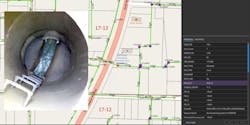
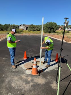
The success of the manhole data collection and inspections lead to many new requests to use ArcGIS. The office staff is now working with GIS to eliminate paper, completing customer concerns and disconnect notifications using apps to communicate with the field crews more efficiently.
GIS has expanded into all departments and has become the cornerstone supporting NGCSD success. The maintenance department uses GIS to complete monthly safety inspections. Even the district’s treatment plant operators have requested GIS support for valve exercising. WW
Esri is an international supplier of geographic information system software, web GIS and geodatabase management applications. Learn more at www.esri.com.


