Exploring the Benefits of Digital Twins
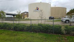
The Gwinnett County Department of Water Resources (GCDWR) operates and maintains water production facilities; reclamation facilities; pump stations; and thousands of miles of pipes that provide essential services to more than 900,000 people in Georgia each day.
On top of challenges related to maintaining and upgrading a vast network, GCDWR has an aging operations and maintenance workforce. Outgoing staff often possess decades of institutional knowledge. GCDWR needed modern tools to operate, monitor, and locate assets once personnel with experienced-based proficiency and awareness retire.
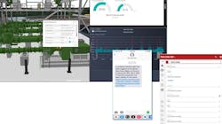
GCDWR and KCI Technologies engaged in a joint pilot project to assess the ArcGIS technology-based digital twin development process and value. More than just a model, a digital twin provides real-time monitoring, analysis, and reporting of operations by replicating functionality in a cyber environment.
The project began with lidar scanning and surveying Gwinnett’s wastewater pumping station, including structure and mechanical, electrical, and wastewater assets. From the point cloud, KCI developed a 3D Building Information Model (BIM) using Autodesk Revit and tied it to traditionally surveyed control points for a real-world location. Assets were attributed with their unique IDs and relevant data such as make, model, and serial number. The model was then converted to an Esri ArcGIS 3D multipatch feature class format. Using GIS, assets and sensors were related to their functional systems and facility — achieving an easy-to-navigate 3D vertical hierarchy not present in most asset management systems. Hosting the information on the ArcGIS Online cloud allowed staff with security permissions to navigate and interact with the 3D GIS in a web browser or ArcGIS mobile apps, eliminating the need for installation of desktop software.
The ArcGIS technology-based digital twin enables operations managers and staff to locate and monitor assets within a rich, 3D, spatially accurate environment. It can also be incorporated with work management systems to identify the location and specifications of assets prior to visiting the site.
“The model, as detailed and as complex as it is, can be made available in the field to frontline employees who benefit from it the most,”Charlie Roberts, deputy director with the Gwinnett County Department of Water Resources said.
With data available through a web browser, information is accessible 24/7 on the user’s platform of choice, including desktop, tablet, or mobile device. Dashboard metrics provide valuable insights that can be used to reduce maintenance issues, extend life cycles, and achieve new levels of optimization.
The project demonstrated numerous capabilities and benefits of the technology and serves as a road map for applying and scaling similar virtual asset management initiatives. WW
Learn more about Esri at www.esri.com.


