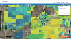
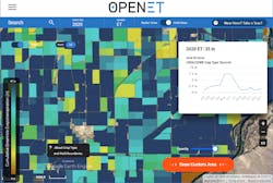
“OpenET provides all farmers, policymakers and communities big and small with the same high-quality data on water use, so that we can all work together from the same playbook to develop more resilient water supplies across the West,” said Robyn Grimm, director, climate resilient water systems, at Environmental Defense Fund (EDF).
The program enables water and land managers to develop more accurate water budgets, water trading programs and other programs. Rosedale-Rio Bravo Water Storage District in California’s San Joaquin Valley will use OpenET in its online accounting and trading platform. Salt River Project in Arizona will also OpenET to improve their understanding of the impacts of wildfire and forest management on streamflow and groundwater recharge.
The “ET” in OpenET stands for evapotranspiration. It’s is a key measure of water consumed by crops and other vegetation that can be used by water managers to better track water use as well as water saved, for instance, when farmers change crops or invest in new technologies.
Evapotranspiration can be estimated by satellites because the process absorbs energy and cools the land surface, and vegetation reflects and absorbs different amounts of visible and near-infrared light depending upon the density and health of the vegetation. These effects are visible to thermal and optical sensors on a satellite. OpenET then combines satellite information with local weather data to accurately estimate evapotranspiration.
Using publicly available data, OpenET brings together six independent models for estimating evapotranspiration onto a single computing platform. The platform’s data has been extensively compared to ground-based measurements collected in agricultural fields and natural landscapes, and tested by a wide variety of organizations through several use cases to ensure the highest accuracy.
OpenET has been developed through a public-private collaboration with input from more than 100 farmers, water managers and other stakeholders. The project is led by Environmental Defense Fund, NASA, Desert Research Institute and HabitatSeven. Additional team members include Google, U.S. Geological Survey, U.S. Department of Agriculture, California State University Monterey Bay, University of Idaho, University of Maryland, University of Nebraska-Lincoln, University of Wisconsin-Madison, UCLA and Universidade Federal do Rio Grande do Sul in Brazil.
The OpenET project has received funding from the NASA Applied Sciences Program Western Water Applications Office, S. D. Bechtel, Jr. Foundation, Gordon and Betty Moore Foundation, Walton Family Foundation, The Keith Campbell Foundation for the Environment, Lyda Hill Philanthropies, Water Funder Initiative, The Laney and Pasha Thornton Foundation, Desert Research Institute Maki Endowment, Delta Water Agencies and the Windward Fund. In-kind support has been provided by Google Earth Engine and partners in the agricultural and water management communities.
Providing local water managers free ET data is a core objective of the OpenET project. For-profit entities and other organizations looking for large-scale access to OpenET data will be able to purchase it through an application programming interface (API) expected to launch in 2022. Revenue generated will fund continuing research and development of OpenET data services.


